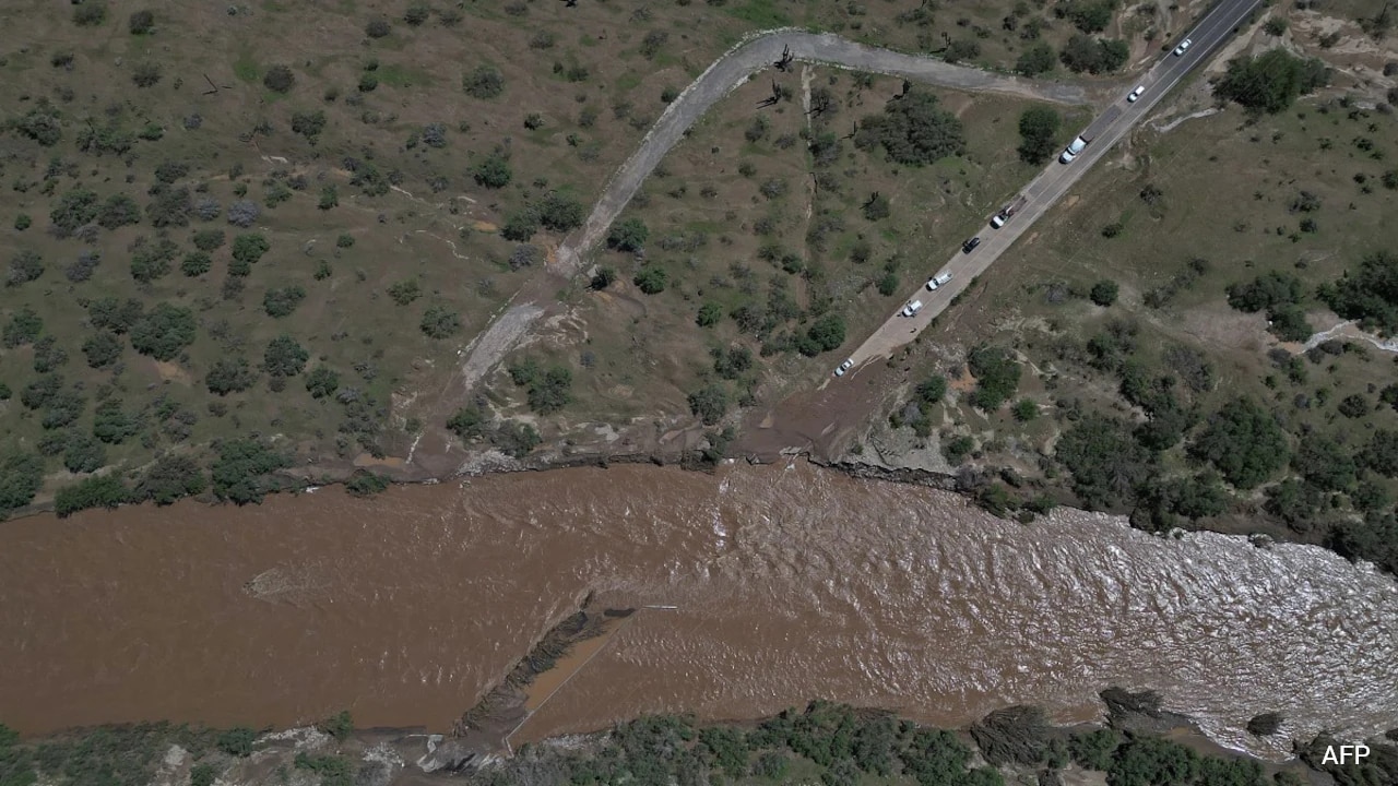
Desert geography changes everything when a tropical system arrives. You get rock-hard soil, almost zero natural vegetation to slow down moisture, and arroyos that turn into raging torrents in a matter of minutes. When former Hurricane Polo pushed ashore in Baja California Sur and then dissolved into a massive moisture conveyor belt, it didn't just dump water on Mexico. It sent an atmospheric punch straight into the US Southwest, testing infrastructure that simply isn't built to handle weeks of continuous rain.
Let's look at the numbers. The region typically receives less than 10 inches of annual precipitation. When a soggy September leaves the ground completely saturated well before a system like Polo hits, every single drop of new rain immediately becomes runoff. There is zero absorption capacity left. Meteorologists in Albuquerque and Phoenix warned drivers repeatedly, yet rescue crews still had to pull stranded motorists from vehicle roofs and pluck hikers out of canyons in Utah and Arizona.
The Anatomy of Desert Flash Floods
Most people assume that dry earth drinks up water like a sponge. In reality, prolonged dry spells bake clay and sand into surfaces that act more like concrete. When torrential bands from a weakening hurricane sweep north, the water stays entirely on top.
Take New Mexico as a prime example during Polo's remnants. Communities along the Rio Grande—including Rincon, Salem, Garfield, and parts of Hatch—faced urgent evacuation orders over fears that local dams and water management systems would fail under the sudden influx. Down in Utah, the East Fork of the Virgin River near Zion National Park transformed into opaque chocolate-colored sludge, dragging shipping containers and trailers downstream like toothpicks.
What Actually Happens When Tropics Meet the Desert
Storm tracks moving out of the Pacific and the Gulf of California during an active El Niño pattern frequently push heavy moisture inland. But Polo's timing collided with an already saturated landscape.
- Infrastructure Strain: Culverts and drainage ditches designed for seasonal brief thunderstorms get choked with debris instantly.
- Evacuation Friction: Small towns lack the extensive early warning networks found in coastal hurricane zones, forcing local authorities to scramble.
- Spillover Effects: Flood watches quickly expanded from the Southwest into the Texas and Oklahoma panhandles, pushing threats eastward toward Colorado, Kansas, Nebraska, and Iowa.
If you live anywhere near a desert wash, an arroyo, or low-lying riverbeds in these regions, conventional wisdom about checking weather apps isn't enough. You have to watch upstream conditions miles away where the rain actually starts falling. Turn around, don't drown, isn't just a catchy slogan—it's the only rule that keeps you alive when an old hurricane's ghost rolls across the border.


